(From the City of Findlay)
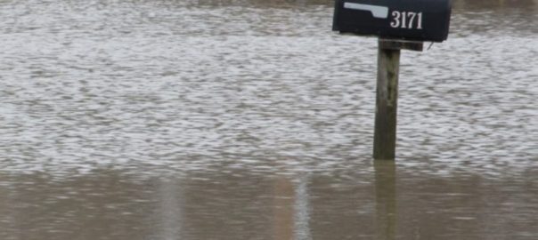
The City of Findlay, in partnership with the Hancock County Commissioners and consulting engineers from Stantec, today announced submission of a Letter of Map Revision (LOMR) to FEMA following the official completion of Phase I benching of the Blanchard River. Once approved, the revision will revise the boundaries and elevations of the Special Flood Hazard Area (SFHA) in multiple locations, removing or reducing flood risk designations for certain parcels. Letters of Map Revision will also be submitted following the additional flood mitigation projects with additional properties expected to be further positively impacted. Click here for the parcels proposed for removal.
Key Impacts
- Reduced Flood Zones: Based on updated hydraulic modeling by Stantec, 375 parcels (totaling approximately 15 acres) will be completely removed from FEMA’s SFHA.
- Lowered Water Surface Elevations: Another 985 parcels (around 67 acres) will remain in the SFHA, but with a reduced 100‑year water surface elevation.
- Yellow‑marked areas in the attached exhibit are those that will be removed from the SFHA.
Background
- The Hancock County Flood Risk Reduction Program, which encompasses several flood mitigation efforts including Phase I hydraulic improvements, has been underway to address rising flood frequency in the Blanchard River and surrounding watershed.
- Phase I involved floodplain benching near Swale Park, removal of several low‑head dams downstream of Lye Creek, and instream riffle construction at low‑head dam sites.
- These improvements, together with property acquisition and demolition of flood‑prone structures, have lowered flood stages as measured at Main Street in Findlay. The National Weather Service revised flood stage definitions in early 2021 to reflect the benefits of these improvements.
What This Means for Property Owners
- Properties completely removed from the SFHA may no longer be required to carry flood insurance under certain regulations, depending on lender, mortgage, or insurance company requirements.
- Those with reduced flood elevations may see lower flood insurance premiums, fewer regulatory restrictions, and reduced risk exposure.
- Affected property owners will need to check with the local floodplain administrator and insurance provider after the LOMR is approved to understand specific implications for their parcels.
Next Steps
- Review & Approval: FEMA will review the submitted LOMR. Once FEMA issues a Letter of Final Determination, the changes become official. This process is expected to take 6 months.
- Mapping Updates: Flood Insurance Rate Maps (FIRMs) will be updated to reflect the changes.
- Notification: Property owners in affected areas will be notified once the revisions are effective. Local officials will provide resources for understanding the changes.
- Continued Mitigation: Additional hydraulic improvements are planned, including additional river benching in downtown Findlay, replacement of the Norfolk Southern Railroad Bridge, and construction of the Eagle Creek Basin with construction anticipated in late 2025 or early 2026.
Quotes
“Phase I benching marks a significant milestone in reducing flood risk for Hancock County. These map changes will bring both regulatory and financial relief for many property owners.” — William Bateson, Hancock County Commissioner
“Progress such as this has been a long time in the works. There is more work to be done but this is a significant step forward in resolving flooding in Findlay and Hancock County. Our goal has always been to create long‑term safety, and decreased expense to Findlay and Hancock County residents.” — Christina Muryn, Mayor, City of Findlay
For more information, for maps showing which parcels are affected visit findlayohio.gov or hancockcountyflooding.com.
About Hancock County Flood Risk Reduction Program
Since the 1990s, Hancock County has been experiencing more frequent flooding. To address this, in 2016 the Hancock County Commissioners and Maumee Watershed Conservancy District (MWCD) entered into an agreement to identify flood risk reduction opportunities. Key projects include hydraulic improvements (benching, dam removal, riffle construction), railroad bridge improvements, and dry basin construction, among others.